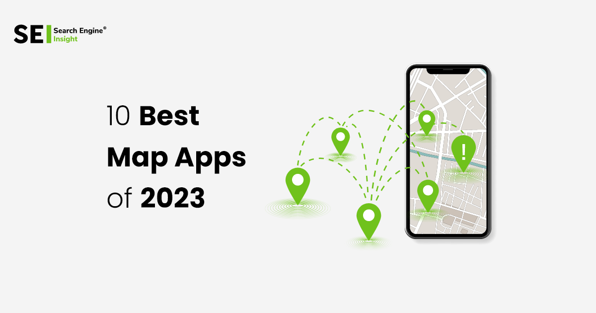
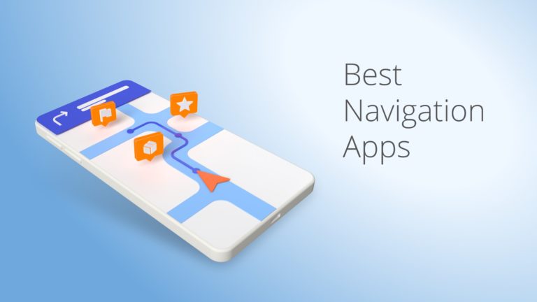
10 Best Map Apps For Android & iPhone 2025
Best Map Apps for Android & iPhone help users navigate effortlessly with real-time directions, traffic updates, and offline maps. This list of 10 apps ensures smooth travel and accurate location tracking anywhere. If I said that a person was lost in the Amazon jungle two decades ago, you would have said that he is dead but nowadays even in such critical situations navigation Map apps come to your service.
In this article, we will guide you about the best navigation apps available out there. These apps have made the impossible happen by developing apps having the whole world shrunk in one place. Let’s first get an overview of what navigation is and what are its primary and secondary uses.
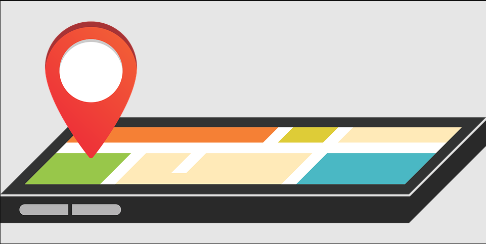
What Are Best Map Apps?
With the help of Map navigation, we may find the quickest and most direct route to our final destination. As a result, we don’t need to ask for directions or worry about getting lost, even if we have never gone to a given address before. Navigation Apps provide direction via on-screen mapping as well as verbal instructions.
If you accidentally miss the turn, the app will automatically recalculate the best route to your destination based on your current location.
In conclusion, navigation can be thought of as a program that figures out the quickest and easiest route between two given points.
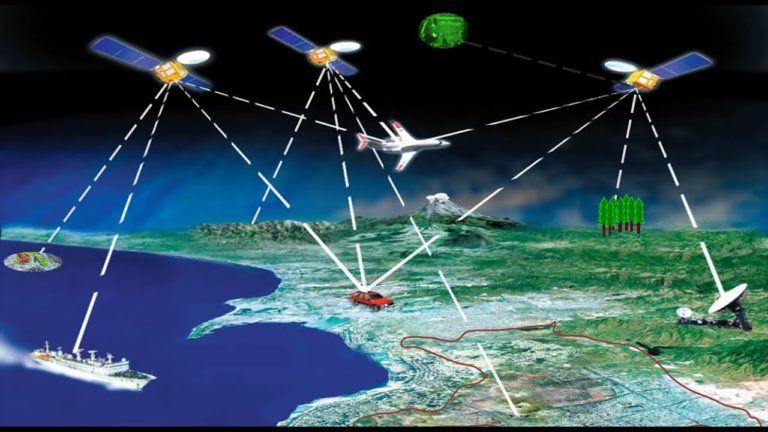
Digital maps created from satellite imagery and ground surveys can be used with GPS devices to locate specific locations on the map. The ability to log in is available to us. These entries are simply coordinated information, and the system can get you to your destination from wherever you are by following the directions you provide (Ex: Road importance order, Main road, Intersection, Intersection… One Way, Vehicles Cannot Enter, Bridges… etc.). Various definitions are taken into account in the resulting calculations.
The approach it takes is generally agreeable to those familiar with Graphs in Discrete Mathematics.
By entering the destination’s address, the system plots a course and provides verbal and visual cues to help us reach our destination safely. The navigation system keeps a close eye on the coordinate data coming in from the GPS receiver at all times. If the journey doesn’t go exactly as planned, a new path is traced from where you are right now to where you need to be.
Now let’s take a look at the components that form the navigation system.
》Software
The system shows the device’s coordinates on the map, plots the most direct route to the destination using the map data, and provides visual and aural instruction, effectively bridging the gap between the map and the hardware.
》Equipment
It’s the hardware/software combo that runs the GPS software/map to figure out where we are on the planet and gets us where we need to go. In most cases, touching the screen is all that’s required for operation. A portable navigation device (PND), an in-car version (in a car), and a mobile app are all available.
》 Maps
It’s the brains of the navigational system. Unlike a regular map, this one includes things like road speeds and directions, rules and regulations, and points of interest. This way, even if you don’t have an exact address, you can still get a sense of your location relative to other landmarks in the area and use that information to figure out where you need to go.
To create a functional navigation system, experts must combine data from numerous fields, ensuring that all of the data is up-to-date and in good shape.
In this way, the quickest and most efficient route to your desired location(s) may be calculated, and you can go there while being guided along the way by both sight and sound.
Best Map Apps For Android & iPhone 2025
Numerous GPS navigation map apps are available for download on today’s smartphones. It’s not always easy to tell which items are worth keeping and which are just a waste of room in the attic. We’ll go over the benefits and drawbacks of the ten useful mobile apps that can get you where you need to go, in no particular order.
Some are designed solely for navigation or determining the best route depending on traffic conditions, while others include extras like the ability to share your whereabouts on social media or identify trails in the wilderness. Many of them provide paid upgrades with additional features on a monthly or annual basis, but the core products are all free to use.
1. 》Google Maps
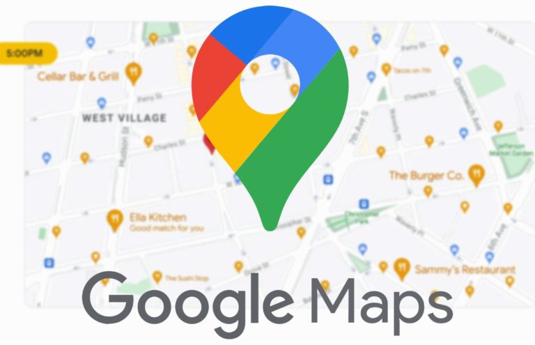
Google first introduced “Google Maps” to the American public on February 8, 2005; the UK followed suit two months later. In that era, Google Maps would not be the only navigation app available. Even before Yahoo maps and Mapquest came out, the market was saturated. To this day, the fact that Google Maps rapidly updated an aerial map of New Orleans after Hurricane Katrina so that people could see the flooded areas makes it easier for people to use the service in times of crisis.
● Location
One of the major hits by Google Maps was MY Location. On November 28, 2007, Google Maps launched “Google Maps for Mobile 2.0”, which featured a beta version of My Location showing the current live Location, which was identified by GPS.
Phones’ built-in GPS systems and nearby wireless devices or cell phone towers are used to determine my current location. It determines the user’s location using data sent and received from the mobile device’s global positioning system (GPS) receiver and cell towers. With the help of My Location, we can always know exactly where we are, no matter what country we happen to be in. It’s quite helpful to be able to use our current location to discover nearby attractions and plan a trip. If we encounter traffic, we can also monitor other routes.
● Traffic Conditions
In 2007, Google Maps included the ability to view traffic conditions via a color-coded overlay on road maps. A significant number of mobile phone users and GPS-determined locations are used to compile road maps and generate traffic maps.
Google Maps also functions as a route planner, providing directions for getting there via car, foot, bike, or public transportation. Also included is the necessary public transportation information to get us from point A to point B.
2. 》Apple maps
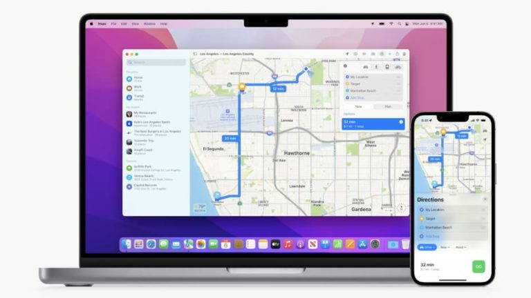
To compete with Google Maps, Apple released its own version of Maps on September 19, 2012. This whole thing was doomed from the start. Little more than a shadow, the Statue of Liberty was hardly perceptible. Apple accidentally referred to a park in Ireland as an airport there. The suspension tower of the Golden Gate Bridge was used as a traffic overpass. A prominent feature of iOS 6, Apple Maps was not yet ready for prime time.
In the immediate aftermath, Apple rushed to solve the most egregious problems. But the situation was so dire that CEO Tim Cook (who had only been in the post for a little over a year at the time) penned an extraordinary open letter apologizing for the rushed release of Apple Maps just 11 days after it was released.
● Multi-Stop
iOS 16 introduces multi-stop routing, allowing you to plot a route with up to 13 stops. This is helpful if you have several places to go in one day, or if you’re planning a road trip that will take several days.
In our experiments, this limiting factor may be increased to a maximum of 13. Touch and drag the drag bar next to each stop to rearrange them, and when you’re done, tap the green Go button. Stops can be deleted by swiping right to left and hitting the Delete button, and their locations can be changed by tapping the stop and typing in a new address.
3.》Waze
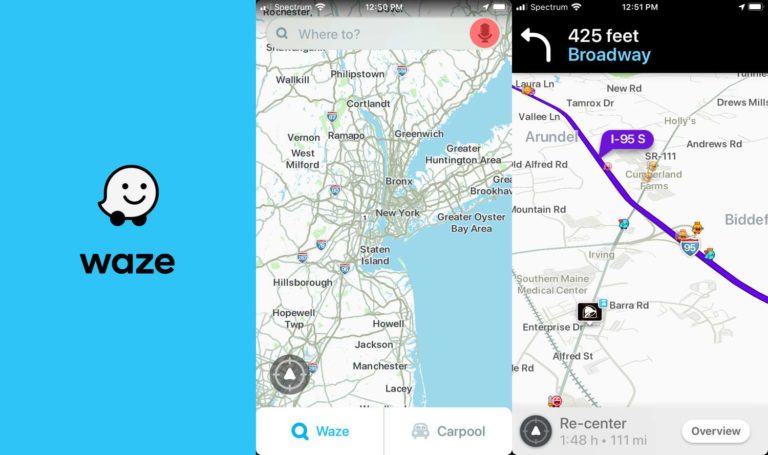
Waze is a free, community-driven navigation app that has helped millions of people get where they need to go quicker since its 2009 debut. Real-time traffic information on accidents, congestion, speed cameras, obstructions, and more is provided by the community of users, map editors, beta testers, and partners. In other words, as Waze grows in size and popularity, the reliability of the data improves naturally.
● Functionality
Waze utilizes data gathered from its user base to determine average speeds, verify the accuracy, and provide turn-by-turn directions. Since this information is time-sensitive, drivers communicate it in real-time to improve traffic flow and infrastructure.
You can actively report issues like traffic, accidents, police checkpoints, blocked roads, bad weather, and more. Waze then uses this information to determine the best route to take. As a result, motorists have the incentive to coordinate their efforts to enhance the safety and satisfaction of all road users.
For proper functionality, the service has to be connected to the internet or a mobile data network. Your inability to find your way or navigate would be greatly impaired without access to the internet.
4.》Maps.me
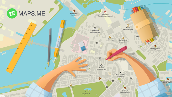
When you’re on the go, use Maps.Me for quick and simple directions at no cost. The app’s high-definition offline maps are useful for exploring new places. Because of its popularity, this offline mapping tool has been downloaded more than 50 million times.
Through Maps.Me, you can save Maps for offline use. You don’t need an active data connection to see turn-by-turn directions and navigation. It’s also possible to get maps for all different regions of the world and download them with this software. Because of its straightforward design, learning to operate it won’t take long at all.
● Offline Maps
There are so many aspects of our lives that the internet has improved. Almost everyone these days uses some type of online activity, whether it be research, communication, shopping, entertainment, etc. Thanks to cell phones, you can now get directions whenever and wherever you need them.
There are times when we can’t get online, which is a major inconvenience. To go around town, we’ll have to rely on other forms of information. It’s a good idea to do some research on where you’re going, like restaurants and hotels, before you get there if you’re driving there. Maps.Me’s offline capabilities come in handy in these situations.
Through Maps.Me, you can save Maps for offline use. You don’t need an active data connection to see turn-by-turn directions and navigation. It’s also possible to get maps for all different regions of the world and download them with this software. Because of its straightforward design, learning to operate it won’t take long at all.
5.》CityMapper
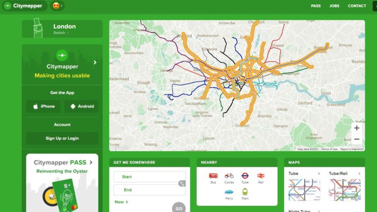
In the realm of smartphone navigation, Citymapper has been a top contender for quite some time. I think it’s superior to Google Maps. More people in the United States can now get access to it.
On Monday, Apple and Google’s rival navigation app revealed that it has added support for 17 more cities in the United States. Pittsburgh, Dallas, Miami, the Twin Cities, and many others fall within this category.
● Enhanced Features
This is significant because, a few days ago, the app was only available in eight cities or regions across the country. However, I find that it provides a superior navigation experience to Google Maps, so I’m glad to see its expansion. (Of course, Google Maps is accessible in a great many more places, namely, everywhere.) In particular, outside of major coastal cities like New York, Los Angeles, and San Francisco, only Philadelphia and Chicago had access to Citymapper.
You should try out Citymapper if you’re in one of these modern metropolises. It’s similar to Google Maps in many ways, but it includes a larger “Get Me Home” button and can display more transit alternatives at once. Simply put, it’s one of the most important buttons ever made.
Even if you prefer Google Maps, you owe it to yourself to at least give Citymapper a try.
6. 》MapQuest
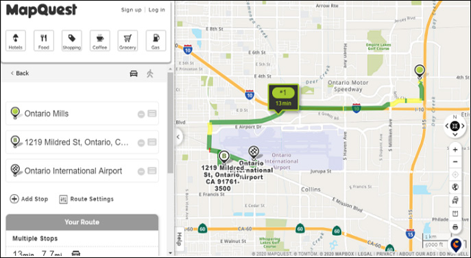
One of the earliest navigation services is now also available as a mobile app. There have been many iterations of MapQuest over the years. But it’s the same trustworthy service we’ve enjoyed for years. A typical direction-by-direction format is employed.
In addition, there is a service that can help you find cheaper gas and real-time traffic reports (in areas where they are offered). In case of a breakdown, you can use it to get in touch with a towing service. Neither GasBuddy nor Google Maps are as helpful in finding cheap gas stations as this one. However, this is a great way to get things done in tandem.
7. 》 Scout GPS
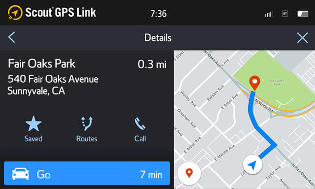
That’s what SCOUT GPS calls itself, an “exclusive social navigation app.” The outdated but still useful GPS app Scout GPS has been updated. It used to be called TeleNav, but now it has a new name and a sleeker design. It retains its reliability and stability as a navigation program capable of performing all necessary tasks, such as turn-by-turn directions.
Scout GPS, on the other hand, has a more distinguishable flavor because it focuses more on people than navigation. Automated text messages can be sent to let people know when you’ll arrive and alert you when someone else requires your assistance. A unique selling proposition is its location-based social networking features. Full access costs $24.99 per year. This method is used by some car manufacturers. Though it isn’t crucial, interesting bits of trivia like that are always appreciated.
8. 》 Mapfactor Navigator
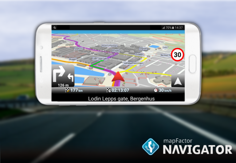
This one is designed exclusively for use without an Internet connection, and it allows you to download maps of numerous countries, regions, and cities. MapFactor is a moderately popular navigation app option. All the standard GPS and navigation functions are there. In this case, OpenStreetMap was used. That’s right, we’re talking about completely free, monthly map updates for your offline use whenever you want them. There is a wider selection of maps to choose from, but they may come at a higher price.
In addition to the standard turn-by-turn directions, this app also provides voice directions, pass routing, 2D and 3D views, as well as day and night modes. Furthermore, this GPS application is compatible with many different countries. Not terrible for what you get.
9. 》OSMAnd
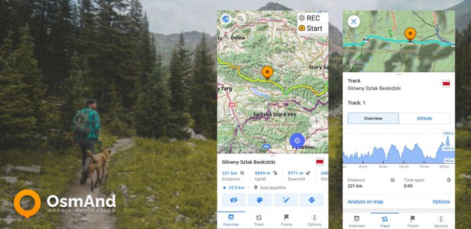
OsmAnD Map is an app that relies on data from OpenStreetMap. OSMAnd leverages two of the largest available collaborative datasets to date. It begins with a base map derived from the extensive user-generated content found on OpenStreetMap (OSM). After installing the free version of OSMAnd, users can only download up to 7 locations.
Wikipedia’s article on landmarks is used as the second source. There are, once again, limitations to this. If you pay for an OSMAnd+ account, you’ll have quick access to WikiVoyage and Wikipedia entries.
With OSMAnd, GPS apps get a refreshing new spin. One of OSMAnd’s strongest points is the way it displays trails for walking, hiking, skiing, and riding a bike. You can save space on your phone’s storage by downloading individual map tiles instead of the entire map.
10. 》 GPS Copilot
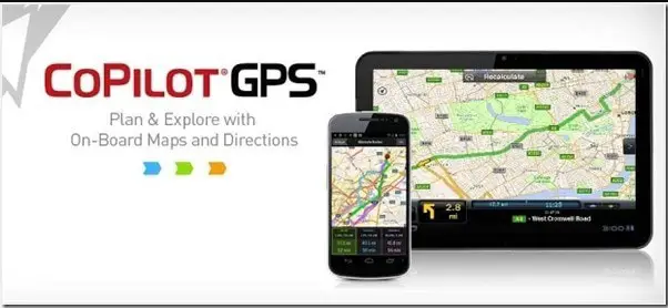
Dedicated to route planning for vehicles other than cars, such as recreational vehicles, large trucks, and others. Instantaneously upon powering on, it prompts you to purchase it. It’s like having a salesperson follow you around at your local Radio ShackThe concept of CoPilot is intriguing. What it’s like to discover your vehicle’s limits while on the road differs depending on whether you’re in a car, truck, or recreational vehicle. That it’s done for your protection and to help you get ready for your voyage is what matters. Undoubtedly, there is a need for it.
Conclusion: Map Apps
In a sense, map apps have made the world a better place by putting the solutions to all of our problems at our fingertips. It’s like having your problem solver and support system in the form of a little screen that you can take everywhere.